GPS Tracking Of Livestock
Aug. 21 | 2016
Tracking Livestock to Quantify Their Activity & Grazing Patterns
Why is GPS Tracking of Livestock Helpful?
The increased knowledge of livestock grazing patterns is especially useful when developing sustainable use of range lands and common pastures.
GPS tracking increases the understanding of how humans and their livestock interact. It also provides information on differences between species and within species such as maternal bonding activities.
The frequency of interactions between lactating female animals and their young can be measured. This is especially helpful with cattle and goats that tend to plant their young in a safe location and return versus sheep that tend to keep their lambs at their side.
GPS tracking of livestock is being used more frequently by farmers to monitor the movements of their animals as they evaluate land utilization and improvement through grazing. GPS tracking data helps farmers understand a great deal about how pastured animals interaction with the land.
What Knowledge will be Gained by This Project?
The knowledge generated by this applied research will be critical to improve current feeding practices of Malian agro-pastoral ruminants. It will allow Dr. Bengaly and his team to understand: 1) the kinds and amounts of feed that ruminants in the Sahel regions are likely harvesting while grazing; and 2) the amount of energy that they expend in doing so.
The discoveries that this technology allows will be important to develop strategies to use feed supplements such as cassava foliage and legume trees in the most effective and efficient manner. Because feeding and nutrition constraints are the most pressing need of Malian agro-pastoral ruminants (Cibils et al. 2015; Outlook on Agriculture 44:69-80) the impact could be significant.
The Process
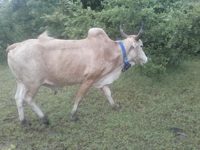
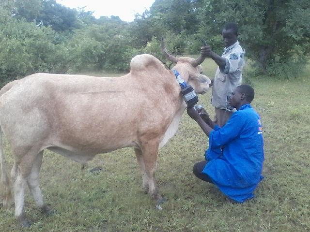
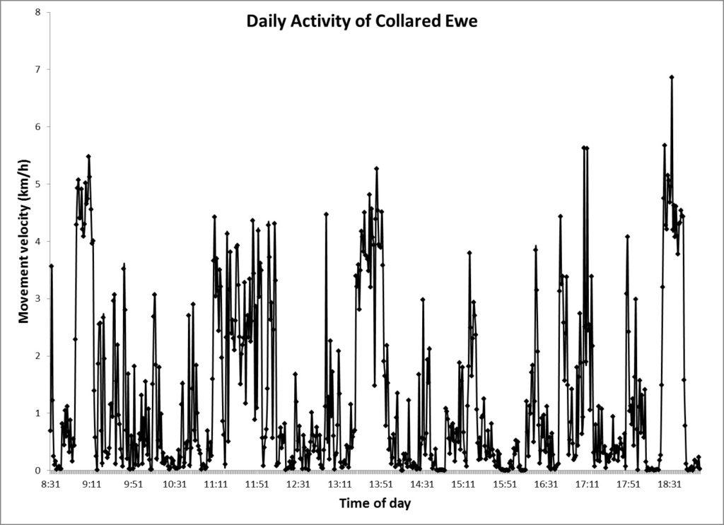
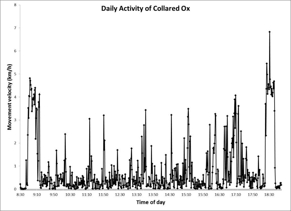
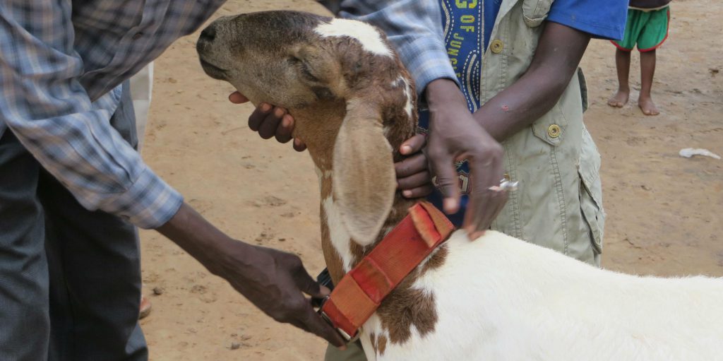
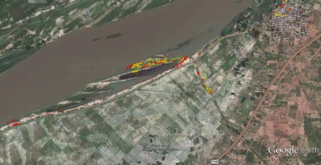
GPS devices were configured to log animal location at 1 minute intervals during the entire pilot study day. Collars were fitted on animals at approximately 8:00 AM shortly before the herder took animals out to graze and were recovered at approximately 7:30 PM shortly after the animals had returned to the village for the night. GPS data were downloaded using a freeware developed by the Minnesota Department of Natural Resources, were given the correct geographic projection (WGS84 and UTM zone 29N) and were mapped on a Google Earth satellite image (Figure 10). Data were also imported into Microsoft Excel and were analyzed to calculate distance traveled by each collared animal and to explore daily activity patterns of the collared goat, ewe and ox.
Six GPS collars and devices were donated to Dr. Bengaly’s lab at the University of Ségou by the New Mexico State University. The collars were assembled with Garmin Etrex Legend hand held GPS fitted with an external D cell battery pack holder.
The Preliminary Results
GPS collar data for the ewe (red points) and ox (yellow points) shown. Animals were herded from the village of Dougoukouna (upper right corner of image) to the Niger River riparian area. The collared ewe and the ox walked approximately 13 and 8.6 km, respectively. The ewe traveled a significant longer distance than the ox.
This project was conducted by volunteer Dr. Andres Cibils, Professor of Rangeland Science, Department of Animal and Range Sciences, New Mexico State University, Las Crusces and Dr. Konimba Bengaly, Project Researcher and Professor, Coordinator Center for Expertise and Applied Research
University of Segou, Mali.
[efsrow]
[efscolumn lg=”6″ md=”6″ smoff=”0″ mdoff=”0″ lgoff=”0″ ]
[/efscolumn]
[efscolumn lg=”6″ md=”6″ smoff=”0″ mdoff=”0″ lgoff=”0″ ]
[/efscolumn]
[/efsrow]
The low points on the graphs show the times when the ewe and ox are probably grazing.

